Wind River Range High Route
~100 miles through the Wind River mountains, bookended by two 13/ers, over 30k feet of elevation gain, 65% off-trail.
General Route Information:
https://fastestknowntime.com/route/wind-river-high-route-wy
Region Information/Resources:
https://windriver.org/experience/driving-tours/wind-river-indian-reservation/
Note: Since I’ve suspended my Garmin subscription plan, the viewing map is no longer available as of Oct 22nd, 2019.
Strava:
https://www.strava.com/activities/2624742142
Pack List:
Base pack weight ~12 lbs | Full pack weight 24.90 lbs
The following website I used is slightly off and shows a heavier total pack weight. I used a scale to weigh my full pack the night before departure, which is where I got the 24.90 lbs.

Trip Report
[related – Gear Junkie interview with Sara Aranda]
August 12th, 2019
Sinks Canyon, Lander, WY
We woke up in the free forest service camping area a minute down the road from our trailhead. Patrick cooked us up some eggs over toast and shuttled us to the paved lot for Bruce’s Bridge. With our nearly 25-lb packs, Emma and I walked to the bridge and stood for a few minutes, facing east towards the faint glow of sunrise.
A week prior, I had spoken to D. Lynette St. Clair over the phone. She’s from the Eastern Shoshone Nation, a descendent of Chief Washakie, and current Education Director for the school on the Reservation. Her main request was that we arrive and leave with respect. Her advice was to listen to the land and to prepare ourselves spiritually. So, that very morning, we asked the mountains for permission to begin, to enter, to embark on the arduous journey ahead.
I had been gifted some aged tea leaves from a friend, significant due to the year they were aged: 2009, the year my mother passed away. For the past several days, I’d been occupied with the notion of motherness and childness, repeating the mantra: Mother, mother, mother nature. Please grant us safe passage. From Bruce’s Bridge, I gave both Emma and Patrick some of the tea leaves. We crushed them down in our palms and held them over the water. Let go in offering. It was time to begin.
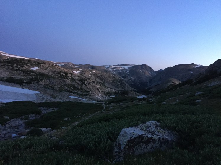
Start time: 6:00 A.M.
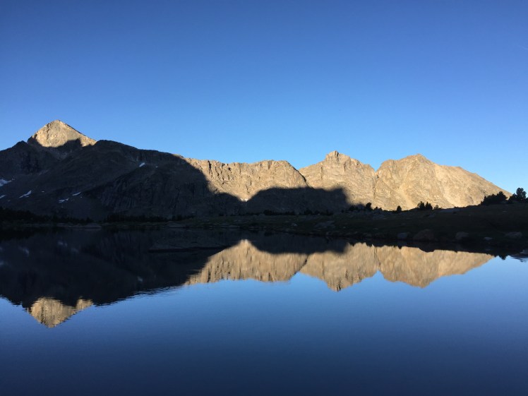
Emma and I made quick work of the flowing trails that steered west towards Wind River Peak. When the first off-trail section began near Deep Creek Lakes, the wind forecast for the day was more than a reality. Thirty MPH gusts rocked our balance as we pushed up the long ramp to our first summit at 13,197 feet. We found another party huddled behind boulders, apparently waiting for the wind to subside. Once they saw us continuing nonetheless, they too began the upwards swim.
In addition to the InReach GPS (which was only making waypoints every 10 minutes), I was tracking our mileage with my Sunnto Ambit3 Peak watch, on trail running mode, for highly accurate readings. By the time we reached the top of Wind River Peak, my watch had us over 19.5 miles, two MORE than what Skurka’s route data had implied. Emma and I were not only surprised but had to contemplate what this meant for the entire route…everything was going to be longer and steeper than we’d mentally prepared for.
Our original plan was: 30 miles day 1, 25 miles day 2, 15 miles day 3, 28 miles day 4.


After descending the very loose and stressful West Gully on Wind River Peak, it was time to navigate our first snow slopes. I’d only ever glissaded once in my entire life, back in college, and all I had then were my snowshoes. I remember crying to myself before I committed to strapping the snowshoes to my hands to use as brakes. Now, with a real ice axe, I watched Emma kick steps across the slope to gain better position. She encouraged me forth and waited. One step, two step, WHOOSH! I was both suddenly sliding and suddenly digging my axe into the slope with the weight of my upper body. Then it was over. Like two snaps of the fingers. The snow was soft and it held me, a small prank I couldn’t help but laugh at.
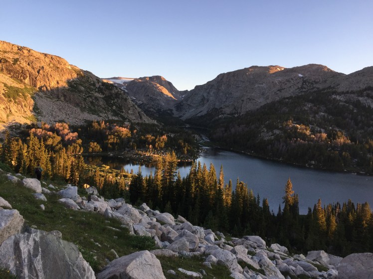
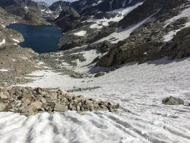
We successfully made our way down the Black Joe basin to Big Sandy Lake, then up Jackass Pass. Time was rolling away and so was the sun. At the summit of Jackass Pass, the sun had set but the moon was bright. At Lonesome Lake, it was utterly dark beneath the trees. We were several miles away from where we originally wanted to be, regardless of having logged 31 miles already. It was 9:00 P.M. and Texas Pass loomed ahead. We decided to stop for the night. We found a sheltered spot to bivy near a small meadow and tucked ourselves into our Outdoor Research Helium bivies. We ate our first cold Backpacker’s Pantry meal (which we’d started soaking several hours earlier), then tried to sleep. The bivy kept collapsing onto both our faces, which made for an awkward dance of hands pressing up and bodies rolling about the night. I awoke to the sound of hooves at some point and peered through the bug screen to see the proud silhouette of a buck in the meadow. It gazed towards us, briefly, before hastily stashing itself away between the moon-shadows.


Total miles: 31.12 | Elevation gain: 11,000+ ft
August 13th, 2019
Lonesome Lake to Europe Peak north slope
4:30 A.M. Our alarms went off and we were hiking around 5:15. Texas Pass is a small alternate on the Primary Route, an easier pass than New York Pass. The distance it added was nominal and both passes brought us to the same Shadow Lake, so we opted for the pass without the visible snow cornice. Sunrise lit the Cirque behind us as we descended the other side of the pass towards a series of lakes.

Shadow Lake meant trails, and we ran them all the way west, then north to Skull Lake. Another off-trail section began, trending northwest towards our first major pass, Raid Peak Pass (the passes previously were small, and I’d been to the Cirque of the Towers before. Everything north of the Cirque was a pure unknown). The land was vast and lush, full of willow, talus, meadow, krumholtz. Creeks bubbled everywhere. Sponga (Skurka’s term for soft or soggy tundra) was abundant. When the wind wouldn’t blow, the sun felt too close. I constantly donned and doffed my Patagonia Houdini. Emma was smart to bring a rain shell with enormous pit zips.
Raid Peak Pass was only one of many tedious talus/boulder hopping obstacles. On the other side we took a saddle north and down 3rd class slabs, skirted lakes to Sentry Peak Pass, an incredibly steep climb up soft grass and more rock. With every obstacle we’d arrive to, I would again repeat my mantra: Mother, mother, mother nature. Please grant us safe passage. I would also often replace mother nature with the specific intimidation I was feeling: Sentry Peak Pass, please grant us safe passage. Photo Pass, please grant us safe passage. On and on it went, bookended with gratitude. Thank you, Sentry Peak Pass, for granting us safe passage.
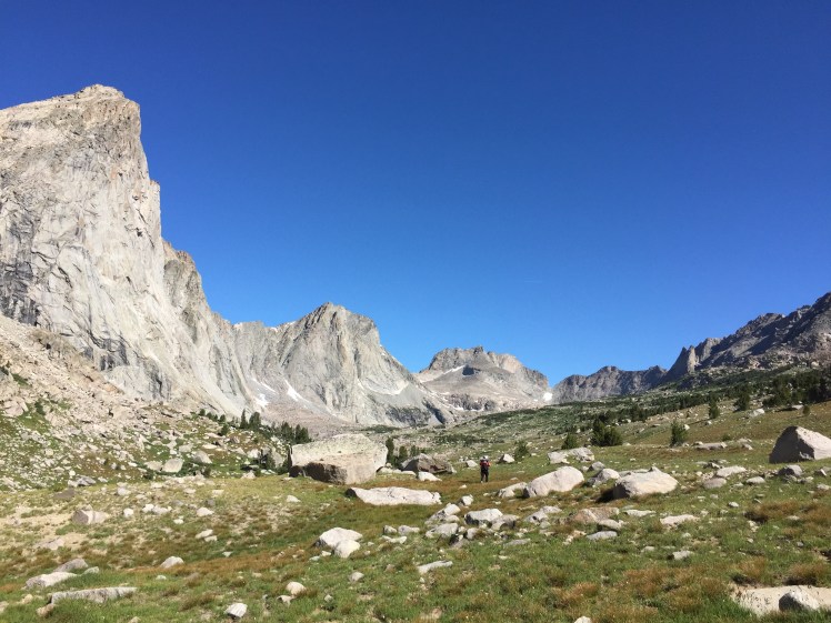

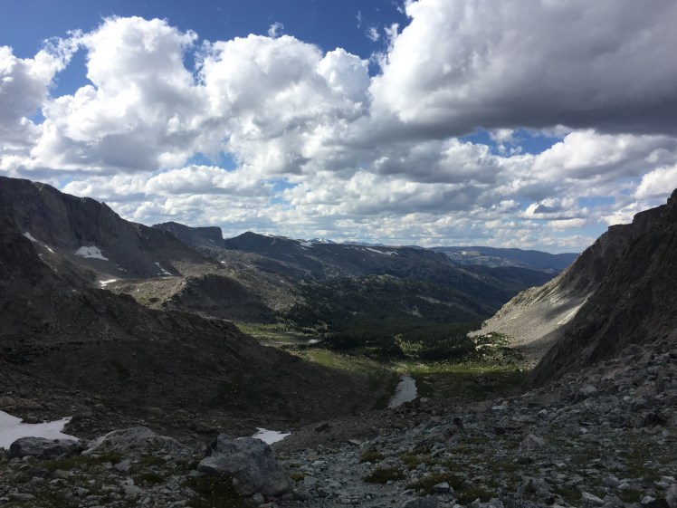
Photo Pass meant we were entering Reservation boundaries. Until now, we had run into only a small handful of backpacking parties, usually happily still at camp or on popular lake trails. We even saw pack-llamas back at Big Sandy, heard climbers up on the walls. Dropping into the Reservation was like dropping into the true wild. The trees seemed all the more warped and twisted, densely knitted into the fabric of the Range. Trails were marked only by cairns and then nothing. We saw no one, had to use our maps to navigate more closely, even started going up the wrong slope at one point. Dusk was approaching and we still had to ascended the east flank of Europe Peak (12,259 feet and symbolic “middle” of the High Route). Our Reservation permit was only for this day, so we felt the pressure of having to make it up and over. So we went for it.
From the Continental Divide, we donned our headlamps and began the 3rd class scramble. Since it was harder to pick out the path of least resistance in the dark, we ended up making some questionable 5th class moves (thankfully we’re both climbers). Suddenly we were on the iconic knife-edge ridge leading towards the head, with the summit beyond a looming high brow. The moon, two days away from being completely full, was a spotlight through wispy clouds. The drop off to the south was a heavy abyss, the bottom too far for our headlamps to glean. The experience was a rush of endorphins and we both briefly lamented the fact that our climbing lives were currently on hold.

It was well past 9:00 P.M. now and while the true summit of Europe Peak was not far away, we decided to forego it and begin our descent off the Divide and off the Reservation. Emma was wheezing and had a deep, phlegmy cough all day. Our goal was Golden Lake, which sat well below 11,000 feet. Yet, just like yesterday, even though we’d logged 29 hard miles already, we were still 3 to 4 miles away. It was 10:40 P.M. and I was crashing hard. My knees were beginning to scream at me as we slowly navigated large talus to a tarn.
“I don’t think I can continue tonight,” I told Emma. My brain had grown a thick fog. It was difficult for me to feel coherent. Emma expressed wanting to descend below 11,000 feet for her lungs. But even that was a minimum two miles away along the Divide. Everything suddenly weighed so much. The entire expedition. The way my body felt slow. Emma was often ahead of me, especially on any descent. I hate descents. My knees hate them even more. Send me uphill and I’ll go forever. But going back down is often a skeletal nightmare for me. Emma’s resilience was as bright as the moon and I felt so weak. While I had earlier felt how possible this whole expedition was, it was now all gone. I was exposed to the wind and the night, to the softness of me.
“I’m fucking up this expedition,” I said to her. My face felt hot. I could feel the surges of hormones, the limbic system ringing from the brain. Emma replied with several things, but the one I remember the most was of course the most painful. Something about having more experience of being in the pain cave than me. Whether it was her intention to diminish me or not, that is exactly what happened.
The urge was to cry or shout or be erratic, and that only compounded with the notion that I wasn’t coherent to myself. So I did what I often do in emotional situations, I went quiet. I wanted to argue, to beat the primal chest in order to prove how she will never know what I’ve been through in life. What pain, physical or not, I’ve endured. That she had no right to distill our lives to “pain cave” moments. But we’ve been close friends for two years now, so I knew that she knew. I knew that this was a mere blip in the cycle of things and us. All I needed was sleep. It was sometime after 11:00 P.M. by the time I dozed off in the bivy, on a small patch of grass in the endless span of stones.
Total miles: 29 | Elevation Gain: ~7,600 ft
August 14th, 2019
Europe Peak north slope to Dinwoody Creek
4:00 A.M. wake up. I somehow managed to sleep well enough, but my appetite was nowhere to be found. We began hiking at 4:29 and quickly encountered our first snow slope of the day. We followed a wide fault line all the way down to Golden Lake, which we aptly reached at sunrise. The trees glowed a deep yellow.
Emma and I had already addressed each other that morning, after pooping, funny enough. I embraced her and apologized for being grumpy. She admitted that one of the main reasons she didn’t sleep at all last night was due to her thinking through the scenario and how she “could’ve said things so differently.”
Today was only to be harder than the days before. Which we’d prepared for by only having a 15-mile goal. But not only were we “behind”, we expected the mileage to continue to be several miles off. We found the Hay Pass trail and followed it towards Douglas Peak, our next pass.
Douglas Peak, please grant us safe passage.

We hugged the cliffs as Skurka had suggested in his guide, and we were sure glad that we did. The slope was made of small, loose talus, except for what existed close to the walls. It was a tedious climb. On the other side, it was more of the same. The gravel slid with our feet and we picked our way down. Emma was, of course, far ahead of me on the descent. Eventually, I couldn’t see her anymore. The talus had grown larger, into full car-sized boulders. I crossed a creek near the lowest of the Alpine Lakes, on the south shore. I still couldn’t see her.
Wow, Emma’s booking it today. I felt a bit sad. Maybe she was tired of me being slower than her; but instead of sulking, I began to hike faster across the slabs and snow slopes that skirted around the lake. There were even footprints across the snow and so on I went to the north side. I admired the melting ice and its bright blue hues. The wind picked up. The next step was to ascend a short slope to a second tier with another lake, but something felt wrong. I couldn’t believe that Emma would leave me behind like this. Maybe it was the mosquitos—they were by far the most intense they’ve been this entire journey thus far. Huge swarms of them, like thick clouds that would erupt from the boulders I touched with feet or hands. Emma loathes mosquitos (I mean, who doesn’t). I imagined her merely wanting to escape the lake because of them. But no, something was tugging at my heart. Those footprints I had followed in the snow were too old to be Emma’s.
Mother, mother, mother nature.

“Emma!” I shouted back across the lake and my voice ricocheted. The granite walls rose over a thousand feet around me. The wind only continued to knot my hair. I thought about her husband at home. What do I tell him? I thought about mine, who was currently hiking into the Wind River Range this very day to meet us at Dinwoody Creek for a resupply. What will he think if we don’t show?
I shouted several more times over a period of about half an hour before I heard a faint, “Sara” from somewhere. I questioned whether the wind had carried it from behind me, on that second tier, or from back on the other shore. Another half-hour passed of me shouting again and again for a second response. Eventually it came, but it made no sense. If she could see me or hear me, she would know that I was on the north side, where she needed to be, but why wasn’t she moving this way? How long do I wait?
This can’t be happening. Come on, Emma.
“Where are you?” I yelled. Emma responded but it was so muffled by the wind. I was convinced I had heard the word “stuck,” and that was the end of me waiting around. I threw on my pack and hastily traced my way back. I was imagining her leg or foot caught between boulders. I thought about the story I had read online about a Priest getting pinned by a boulder in this very basin. He perished after a week and his dog was found roaming. I filtered through my 6 years of Wilderness First Responder training, prepared to arrive calm and ready for action. The InReach dangled from my pack. The wind carried strange sounds. Was she crying? Is that the lake? We were so alone.
As I got closer to the base of the pass, I shouted her name so I could hone in on her voice. I even started clicking my poles together so she could hear me if I happened to pass her. Then I saw her. She was sitting cross-legged on a small, raised patch of grass, writing in her journal…
“Emma!” I’m dumbfounded.
“Where are you?” she replied looking around.
“Over here,” I said waving my poles. She saw me.
“Oh my fucking god!” She buried her head, seemed to melt.
“WOO!” I shouted with pure relief.
She informed me that she had been waiting at the base of the pass. When she never saw me, she was confused and began her own search back up the pass. She climbed up and down and up and down, shouting my name as well. When she thought she heard something, she couldn’t decipher it. Our names both end with the same syllable. She thought she was losing her mind, so she began making notes in her journal with the exact time she believed she last saw me. Her iPhone was the one we paired with my InReach, but since I was out of her Bluetooth range, she could only see the waypoint made before we got too far from each other, which was in the middle of the descent of the pass.
“Let’s make a pact,” she said. We were to always keep each other in sight and to wait before and after any navigational or physical obstacle. Always. And with that, we pressed on, two hours lost to the walls and wind.
Alpine Lakes Pass, please grant us safe passage.


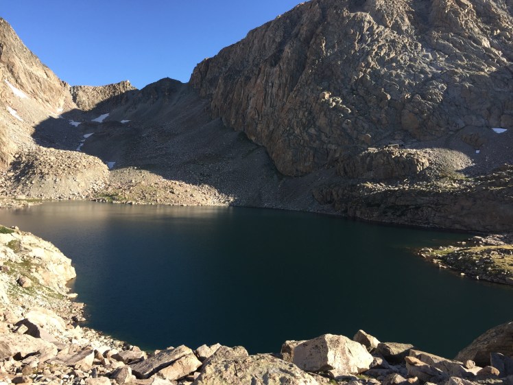
The pass rose north from a terminal moraine with a long, steep swath of snow. We had just scrambled over and around lake bluffs and now had to pull the ice axes out. I had never climbed a snow slope with an axe before. Emma kicked steps and led the way. I’m not afraid of heights, I’m afraid of falling. In rock climbing, the fear of falling is what has kept my progress below perceived potential. Only recently have I even begun to scratch the surface of the 5.12 realm, and it’s been 10 years. So I tried not to think about falling as I watched the rocks and the lake get smaller and smaller, the long tongue of soft snow leading us towards some unknown precipice. I pulled down my visor to create a barrier around my vision. One step at a time. Axe, step, axe, step.
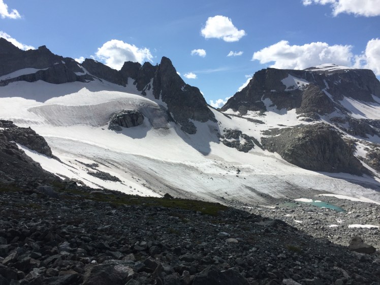
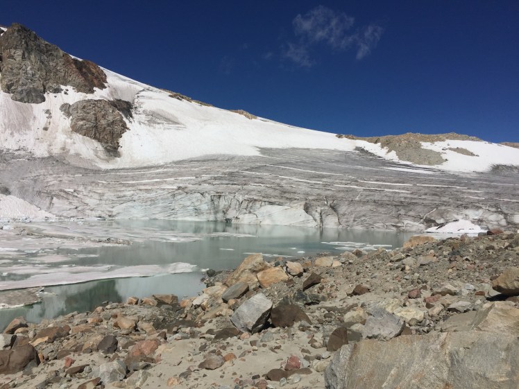
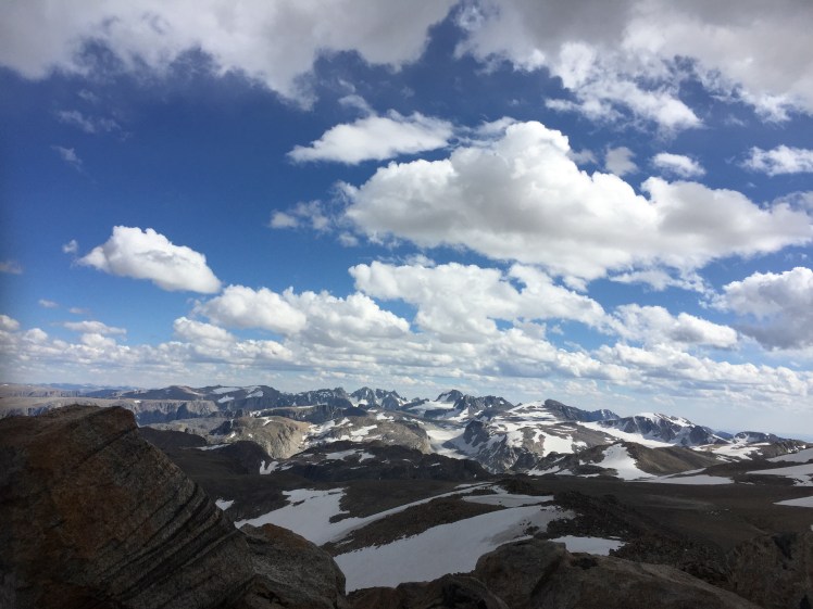
One thousand feet up, it was finally over. On the other side, the Range continued in its vastness. We saw the final pass of the day, Blaurock Pass, across a valley carved by KnifePoint Glacier and others, which sat, sadly shrunken (but still immense) to the west. A small mountain resided between us and yet another valley before we could even begin the Blaurock climb. Patrick, my husband, was waiting all the way on the other side.


At the bottom of the first valley, it was time for our first wet creek crossing. The water was milky blue with glacial flour. Luckily the creek was wide and not incredibly deep, so at most we were up to our ankles as we picked rocks to cross. Up and over a steep, unnamed rise, we dropped down into the North Fork Bull Lake Creek basin. This creek was also glacial meltwater and was to be the hardest of the water crossings on the entire route. With so much water this year from such a hefty winter, Emma and I had built up some treacherous visions. It was definitely deeper and faster moving, so we carefully picked a line, went in thigh-deep at times using our poles to measure and find hidden rocks to step on.
-

Descending to North Fork Bull Lake Creek, with the nearly 2,000 foot Blaurock Pass in the middle.

Blaurock Pass, please grant us safe passage.
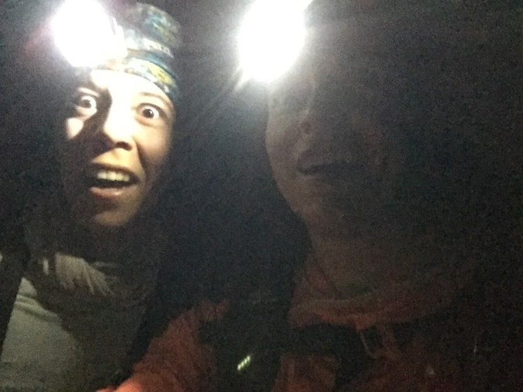
On we went, over loams to a floodplain (that was very flooded). We began the climb up Blaurock at dusk. Near the top, we donned our headlamps and had to navigate the descent entirely in the dark. We’d find a trail then lose it, find ourselves briefly cliffed out, find snow and endless talus. We had no choice but to push until we met Patrick. Eventually, we could see headlamps where his trail ended. Like fireflies seeking other fireflies, we slowly floated forth.


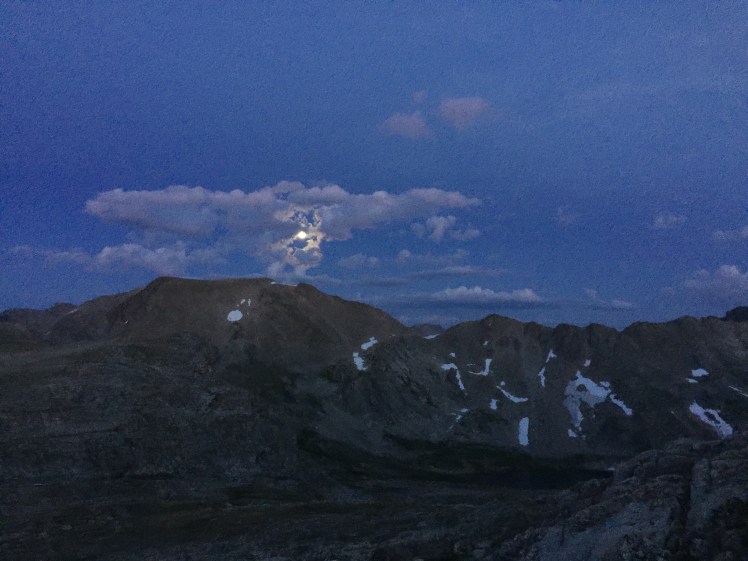
Then my headlamp died and we had to travel even slower. Emma would move then turn to light my way, then repeat. The moon was out but the walls and mountains were so tall they blocked it. A harsh shadow was cast across the valley, hiding any camps or people from view.
It was after 11:00 P.M. when we made the final creek crossing of the day, Dinwoody Creek. We found tents but they weren’t Patrick’s. No one was signaling to us or shouting our names. An enormous boulder field sat before us. It seemed impossible that we would be able to find him in the dark. Then, out of nowhere, we saw two people walking our way.
“Patrick?” Emma asked.
“No, but who are you?”
“Emma and Sara.”
“Oh! I know Sara!” he said, then turned to me. “It’s Chase.”
“Oh my god, Chase!” I said. A friend from Boulder, I couldn’t believe it.
“What are you doing here?” I asked.
“I’m guiding up Gannett,” he replied, seeming to imply the other person was his client.
“Do you know where Patrick is?” Emma asked.
“I didn’t physically see him but I know he’s camped right up there,” he replied, pointing us west. And so easily did we find the tent after that, we were beside ourselves.
Apparently, Patrick was telling everyone he came across about us and what he was there for. Whether it was chance or otherwordly intervention, Chase had appeared exactly when we needed him.
We shook Patrick’s tent at 11:30 P.M., who awoke with such disbelief and joy. Emma immediately grabbed his JetBoil for our first warm meal of the trip. My appetite was hard to muster thus far, but the hot Mac & Cheese went down mighty easily. Then the brain fog returned with a vengeance. Patrick would talk to me and I would barely respond. I had all these tasks I was trying to remember, but couldn’t, so I gave myself tasks nonetheless to keep myself sane. Like stuffing my bivy sack back into its bag.
“Don’t you want to use that?” Patrick asked. I remember nodding but my body still stuffed it anyway. We were all going to cramp into Patrick’s tent, so I played it off. I was only going to use the emergency bivy (the one that I knew wasn’t very warm). Emma and I didn’t bring sleeping bags, but she had a higher quality emergency bivy and a silk liner. I had given my better emergency bivy to Patrick for him to use before this adventure even began (“Now that’s love,” Emma had said). Now I was cuddled next to him and shaking, convulsing even. He kept asking if I wanted to trade bivies, but I was too withdrawn and wanting to conserve energy to even say yes. It was almost 1 A.M. He wrapped himself around me and held me, for hours. I don’t even know how I fell asleep.
Total miles: 23.9 | Elevation gain: 8,087 ft
August 15th, 2019
Dinwoody Creek to Trail Lakes TH
4:30 A.M. I dragged myself out of the tent. My feet were beginning to swell, my knees were stiff. My dinky emergency sack was soaked inside. Emma heated water to rehydrate our breakfasts.
One more day. One more day. Mother, mother, mother nature.
I admittedly didn’t move very fast that morning. I was still trying to comprehend what my body and mind had gone through only hours earlier. Was it dehydration? Volemic compensatory shock? What nutrients was I lacking?
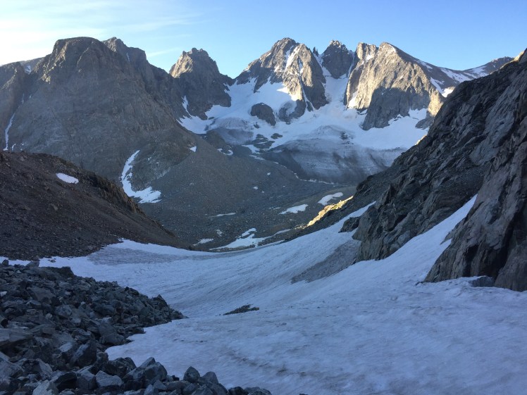
But as the sun rose so did my spirits. We scaled up the icy West Sentinel Pass, stopped to put on our crampons for the first time this trip, yet another first-time experience for me: crampons. Emma led us across the crunchy slope, telling me how crampons work in all directions of orientation. She had one foot facing downslope and one in the direction of travel. I tried to mimic her but felt the insecurity of myself. It’s one of those things, like using cams for climbing. It takes time to trust your gear; time is exactly what I didn’t have at that moment. So I paused, took out my ice axe while balancing precariously and decided to use it as a pick. I faced the slope and closed my eyes, let the sensation of panic flow through and away, then swung the axe into the hard snow, side-stepped, swung, stepped, swung until the slope backed off. Then, at the top, it was time to cross our first glacier.
Gannett Glacier, please grant us safe passage.


Gannett Glacier is a mile crossing to a steep exit near a nunatak. We could see the crevasses off in the distance, like wrinkled skin around a joint. A group of CDT hikers appeared, heading our way. We stopped to chat with them. They were all in shorts and as tan as movie stars. Only three of the five had microspikes. The other two had just their shoes. I was amazed. They were able to tell us about the crevasses, that the ones we’d near or cross over were incredibly small and “hoppable.”
So we crunched away and hopped. The glacial ice was strange looking. The way it melted often looked like mini, upside-down chandeliers and even when we walked over them, they didn’t shatter. The ice was so hard. Little creeks and streams of meltwater carved channels in every direction.
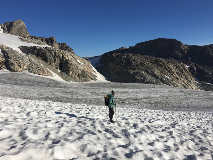
After crossing, we had to ascend up a saddle and down to our second glacier, Grasshopper Glacier. This time, we only had to cross the toe and up a snow slope onto the Continental Divide. As we approached, there was a blue lake and the thickness of the glacier was immense. Chunks were broken and dangling into the water. We found a safe place to step onto the glacier, where the rocky land rose like a bridge. Then across and up we went, the snow slope soft beneath the sun and rippled into a corrugated sheet.

We only had a few “obstacles” left: Iceberg Lake Pass, Downs Mountain, No Mans Pass, and the long, talus-filled Goat Flat. Time wasn’t as fleeting as days prior and we felt confident about finishing. Thus, on and on we went. Boulder hopping, snow slope scaling, talus walking, repeat, repeat. The crampons had given me blisters and I could feel them burning. Our shoes never dried from the previous day’s water crossings and with every new bit of snow, our socks would dampen all the more.
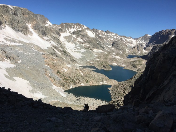
-

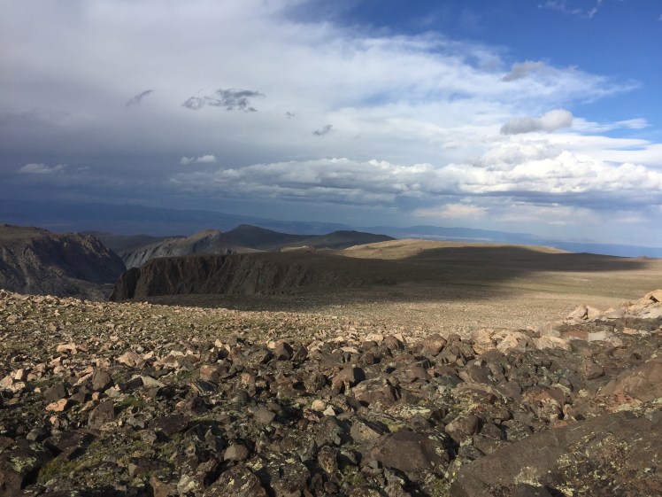
Looking south from Iceberg Lake Pass.
We topped out a pile of boulders on Downs Mountain (13,350 feet), only to see another pile only a hundred yards away or so. So we’d top that one, only to see yet another pile that looked questionably taller. Close enough, we decided. We were so tired. I shared my Snickers bar with Emma when the clouds began to release miniature flakes of snow. We descended the east slope. We could see the long tundra ramp of Goat Flat, where, at its end, lay the final trail to the end. Directly before us was at least 1,000 feet of glissading. Emma jumped right in. I couldn’t believe how steep everything looked. But I wasn’t going to take the tedious, rock-hop down. So, as Emma waited at the bottom, I pulled my warmer sleeping pants over my leggings, took out the axe and released a deep breath.
Downs Mountain, please grant us safe passage.


“Let’s go,” I said to myself. I walked onto the snow and down I went using the axe like an oar, paddling myself through the annoying ripples and truly wishing for more speed. At the bottom, we were both thoroughly soaked but psyched. The clouds draped the mountains we had traversed, all the way back to Wind River Peak. I couldn’t believe what we were looking at. I had envisioned ourselves being there for so long.
Little did I know that the Goat Flat would be the hardest section of all. Not for its steepness or technicality, but merely for the mental endurance it required. It was over 4 miles of uninterrupted talus. My knees were starting to scream again. My blisters were growing. The sun was disappearing. Emma was ahead. I sang to myself as a distraction. I sang and I sang and I ground my teeth as I willed my body to move despite pain.
When we hit the Glacier Trail it was last light, but I knew this trail. I had scouted it a month prior. I was finally ready to enter the proverbial cave. Emma was behind me as we began to run. And we ran the longest 8 miles of our lives. Every step more painful than the last, but ever closer to home. Halfway through, I felt a blister rupture on the bottom of my left foot and it felt like I had a hot coal in my shoe. Why now?! But I didn’t stop. There was no way I was stopping. Stopping would only make things worse. I had to ride the edge of lunacy and function. So I limped and ran. Ran out of water. Ran until both Emma and I were grunting our pains into the night. Finally, our headlamps lit up the cars in the trailhead parking lot and we honed in on the little wooden sign.
End time: 11:20 P.M. We actually made it. We actually did it.
Mother, mother, mother nature. Thank you for granting us safe passage. Wind River Mountains, thank you for granting us safe passage.
We found my van with Patrick sleeping inside. Once again did he wake in disbelief. Emma and I peeled off our shoes and socks; our feet looked so zombie-like. It was time to eat and pass out, let our heads spin with euphoria.
Total miles: 28.11 | Elevation gain: 6,594 ft
6:00am 8/12 to 11:20pm 8/15
Total Time: 3 days, 17 hours, 20 minutes
Total Miles: 112.13
Total Gain: 33,281 ft
